NASA Images Show Brazil’s Lençóis Maranhenses Shifting From Desert To Lagoon
NASA imagery reveals Brazil’s Lençóis Maranhenses transforms from desert to lagoon system annually. This dynamic ecosystem supports unique wildlife but faces threats from climate change and tourism.
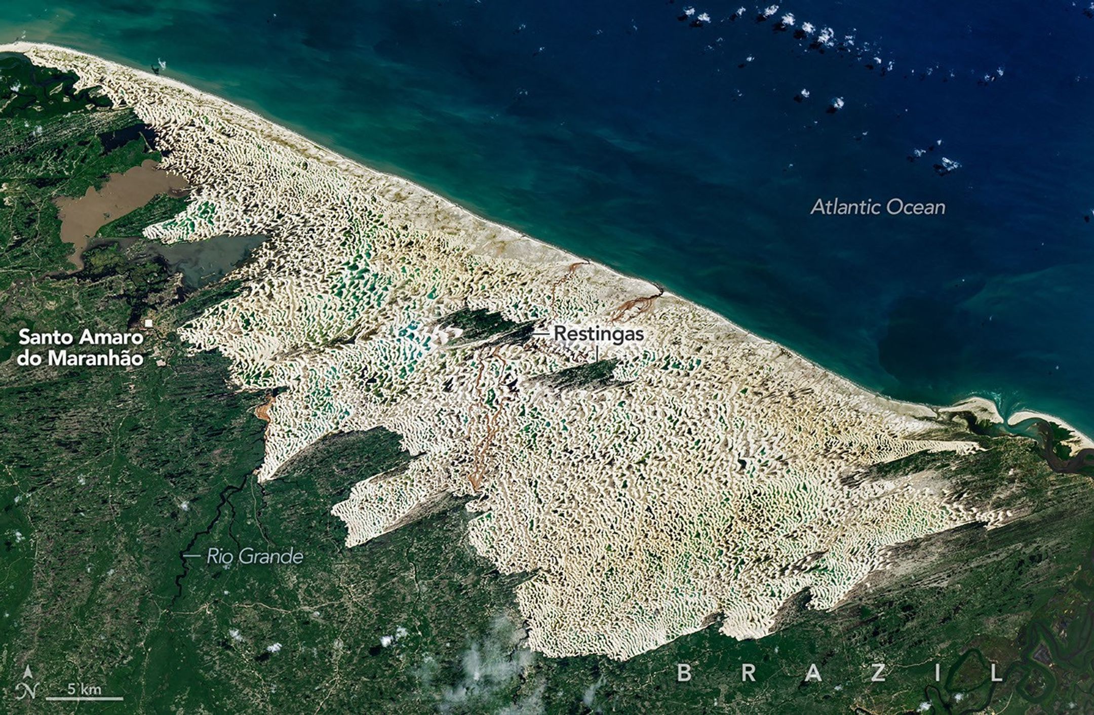
NASA satellite images released this week show Brazil’s Lençóis Maranhenses dune field, long thought of as a barren desert, transforms into a sprawling network of freshwater lagoons every rainy season. The park’s 120‑kilometre stretch of wind‑blown sand, located on the Atlantic coast of the state of Maranhão, fills with crystal‑clear water between January and June, creating a surreal landscape that attracts photographers, trekkers and scientists alike. The phenomenon was highlighted in a new dataset that uses LIDAR and multispectral imaging to map dune movement and water accumulation in real time.
The park’s unique ecosystem depends on the region’s tropical monsoon climate. Heavy rains from the Atlantic push moisture inland, saturating the porous dune sand and feeding a shallow groundwater table. When the water table rises, it spills into depressions between dunes, forming lagoons that can cover up to 70 square kilometres at their peak. NASA’s observations confirm that the dunes are not static; they shift by several metres each year, a process driven by wind and the weight of the water. The lagoons provide critical breeding grounds for migratory birds, fish, and a variety of amphibians, many of which are endemic to the area. The interplay of sand and water also creates a natural laboratory for studying coastal geomorphology and the impacts of climate variability on fragile landscapes.
The paradox of a desert turning into a lake basin has implications far beyond scenic beauty. As tourism booms, local communities rely on the park’s reputation to bring in revenue, but unregulated foot traffic can damage dunes and erode fragile habitats. Conservation groups are working with the Brazilian government to establish visitor limits and develop boardwalks that minimise erosion. Meanwhile, climate scientists are using the park as a climate change indicator, monitoring how shifts in rainfall patterns could alter the timing and extent of lagoon formation. Future satellite missions will continue to track dune dynamics, providing data that could help predict the park’s resilience to rising sea levels and increasingly erratic rainfall.
Read Full Story at NASA →