Heightmap / Image to STL Relief Generator
Convert a grayscale image or terrain heightmap into a 3D-printable relief STL · free, no signup
See Heightmap / Image to STL Relief Generator in action
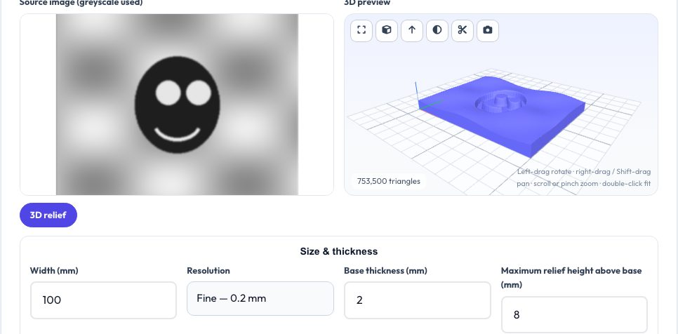
Free Heightmap & Image to STL Relief Generator
A heightmap is a grayscale image in which brightness means height. This tool turns any image — a terrain map from a GIS tool, a depth map from a camera or AI model, a logo or a texture — into a watertight 3D relief with a flat base. You choose the model width, the base thickness, the maximum relief height above the base, the sampling resolution, and whether white or black is the high point. Contrast, gamma and smoothing sliders clean up noisy maps before the mesh is built.
The result is a solid STL with a flat bottom, ready to print flat with the relief facing up: mountains and valleys from terrain data, raised logos on coasters, embossed textures, bas-relief portraits. A live 3D preview with a section tool lets you inspect it before downloading.
Key features
Grayscale to height
Brightness mapped to relief height above a flat base.
Controls
Width, base thickness, relief height, contrast, gamma, smoothing, invert.
Watertight solid
Closed manifold mesh with a flat bottom.
Private
Images are processed locally.
How to use it
- Drop in a grayscale image or depth map.
- Set the width, base thickness and maximum relief height.
- Adjust contrast, gamma and smoothing; invert if needed.
- Download the STL and print it flat.
Worked example
Example
A 600×400 px terrain map scaled to 120 mm wide with a 2 mm base and 10 mm relief gives a 120 × 80 × 12 mm model — about 960k triangles at 0.2 mm resolution, or roughly 430k at 0.3 mm.
Who uses this tool
Makers and map lovers
Print terrain and topographic models.
Designers
Create embossed logos and textures.
Educators
Visualise data as 3D shapes.
Tips for the best results
- Use 16-bit or high-contrast images for smoother gradients; smoothing removes stair-steps.
- Keep the relief height modest — steep slopes need good layer adhesion.
- Print at 0.12–0.2 mm layers for smooth surfaces.
- Invert for engraved/recessed designs.
Common mistakes to avoid
- Using a very large image at fine resolution (too many triangles).
- Expecting colour to carry over — only brightness is used.
- Forgetting to add a base thick enough for stability.
Why use AZRS QuickFix?
It is 100% free, needs no signup and has no watermark or usage limits. The tool runs in your browser, so what you type stays on your device, and it works on phones, tablets and desktops. New tools are added every week — bookmark this page or browse the full QuickFix toolbox.
Frequently asked questions
What image formats work?
PNG, JPG, WebP and GIF. Use grayscale for best control.
Can I use satellite terrain data?
Yes — export a heightmap image from your GIS tool and drop it in.
How do I make the surface smoother?
Increase smoothing or reduce the resolution step.
Is it free?
Yes, with no watermark.